


Story
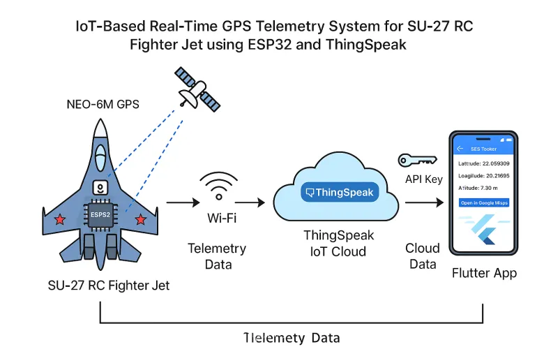
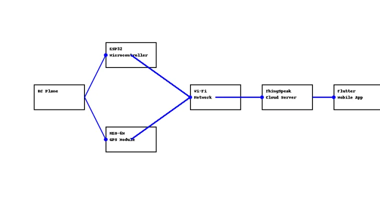
SkyLink AI is an AI-powered GPS telemetry platform for an SU-27 RC Jet, using ESP32 and GPS to collect live flight data and transmit it to the cloud. A trained ML model (deployed via FastAPI) predicts the flight safety level at any moment based on current speed, altitude, and location. The system is accessible through a beautifully designed Flutter mobile app and an intuitive web dashboard.
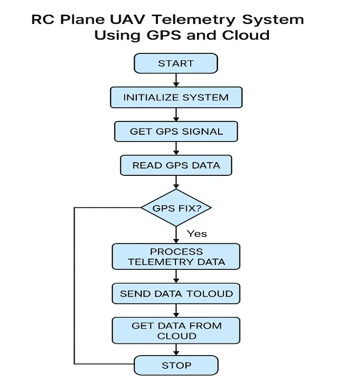
System Flow:
-
ESP32 reads GPS data via UART
-
Sends data every 5s to ThingSpeak
-
Web and Flutter apps poll the data
-
Apps send inputs to FastAPI ML model
-
ML predicts and returns Safe/Risk
-
User sees real-time risk level on dashboard
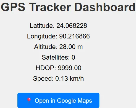
ML Use Case Example:
-
Location: 24.07° N, 90.21° E
-
Speed: 12.5 km/h
-
Altitude: 11.3 m
→ Prediction: “⚠️ RISK - Too fast for this altitude/location zone”
-
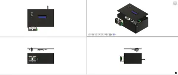
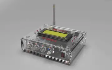
ESP32 + GPS hardware close-up
-
RC Jet in flight
-
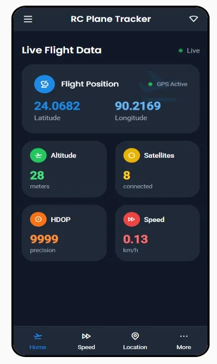
Web app and flutter app:
-
Web dashboard showing “Safe” / “Risk”
-
Flutter app’s real-time display
-
FastAPI server with prediction logs
-
-
ML training data / model architecture